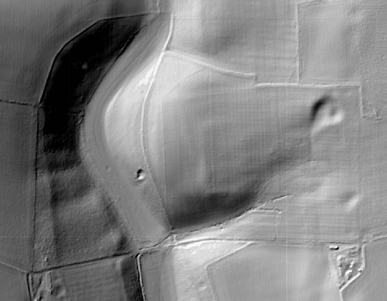
LIDAR Image of Aper Vallis today
On the left, the slope rises from the (now dry) bed of the Afon Turk, across the coomb. The top of the ridge is where Serena gathered daffodils in rhe story’s opening, and further north, lies her mother’s gravestone.
In the centre, on the promontory, the regular, rectangular shape of the villa walls remain visible.
In the top right is a depression, the quarry cut used to source the villa’s construction, and later teh site of the shrine. A spring rises there, flowing south down the site.
Disturbed ground at the bottom marks the location of the original villa built by Doccius on the site of Udo Cunnos’s grand roundhouse.
The course of the riverbed meanders to south to Kommturk/Turkdean, some two kilometres south.
Acknowledgements
Maps and images on thios page © MapTiler, presentation © LiDARFinder | data © various providers, © MapTiler © OpenStreetMap contributors
